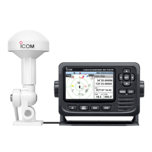
The AIS displays information about the AIS equipped ships, as well as, coastal stations and Aids to Navigations within VHF coverage. Outputs AIS data to ECDIS, radar and other navigational equipment for collision avoidance support. Sufficient output ports for dual configuration of ECDIS and radar system. LAN interface available for efficient network integration into a bridge system. Receives AISSART signals for assisting in streamlining SAR activities.
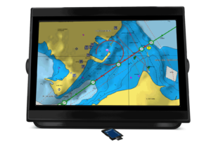
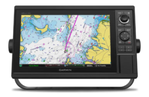
Chart Plotters
A Chart plotter is a device used in marine navigation that integrates GPS data with an electronic navigational chart (ENC). The chart plotter displays the ENC along with the position, heading and speed of the ship, and may display additional information from radar, automatic information systems (AIS) or other sensors.
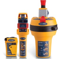
EPIRB & SART
EPIRBs and SARTs are essential tools for the safety of seafarers. EPIRBs allow for the quick and accurate determination of a vessel’s location, while SARTs attract the attention of other vessels in the vicinity and provide direction for a rescue effort.
GPS
Excellent functions and features of the GPS includes – Combination of GPS track plotter and full function dual frequency echo sounder, Daylight-viewing TFT LCD with LED backlighting for long service life, Split screen display of simultaneous track plotting and dual/single frequency echogram, Built-in electronic chart of user-specified area, eliminating need for chart cards
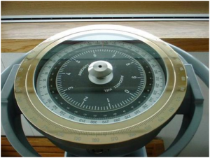
Magnetic Compass
The wide range of equipment offered Compass Systems includes aluminum alloy binnacles, the magnetic flat glass compass, a flux-gate pick-off with an integrated sine/cosine interface, bypass arrangements, azimuth devices and magnetic compass autopilots (TMC). All of these products are manufactured to high standards for highly reliable navigation of your vessel.
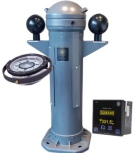
Gyro Compass
The gyro is designed for high precision
maritime applications such as offshore
operations and seabed mapping. Gyro and
GPS compasses offers something to complete
every electronics system. Providing accurate
and reliable data for safe navigation, our
flexible IMO and non-IMO system
configuration options make both new and
retrofit installations into existing systems so
simple.
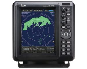
Radar
The Radar function displays moving targets, stationary targets, sea surface and targets closing in on your vessel in different colors. Spot hazardous targets directly, simply by their color. It only takes a few seconds after the target has been selected, for a speed and course vector to be displayed. With accurate tracking information, estimating other vessels course and speed is made easier.
UHF / VHF Radios
UHF is a short-range communication frequency band that operates in the 300 MHz3GHz bands, where radio waves are very compact, operate at higher frequencies, and have strong signal penetration, enabling UHF to communicate through obstacles (e.g. walls, concrete), it is practical in built-up environments, indoors and within urban areas. VHF is radio frequencies in the range between 30-300MHz, which has longer wavelengths and provides a larger broadcast range, it is commonly used in outdoor applications. Understanding the differences between the radio frequencies to decide which one is best for your needs.
VDR
Meets the latest performance standards and technical requirements, as defined in MSC.333(90) and IEC 61996-1. Designed specifically for maritime application down to the last component, the VDR offers high quality and reliability in a compact and lightweight, easy to install solution. The VDR is IMO compliant.